

Africa in 1886
Tap/click to see more details
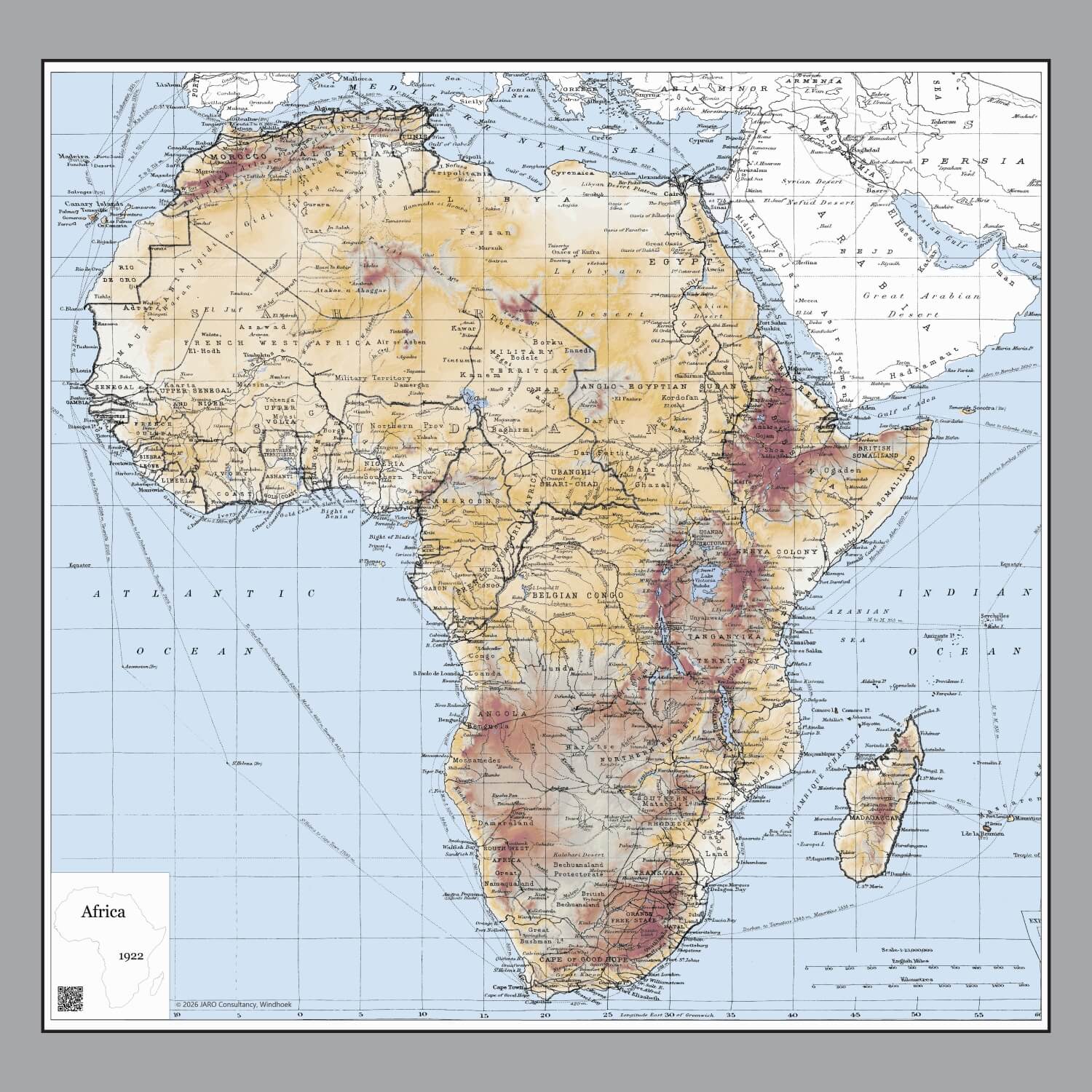
Africa in 1922
Tap/click to see more details

Africa in 1967
Tap/click to see more details
Tap/click to see more details
Tap/click to see more details
Tap/click to see more details